How an Early IMU Selection Can Determine Whether Your System Continues Navigating After GPS Is Lost
We’re all familiar with navigation systems that display an accurate position on a map, follow a planned route, and provide real-time velocity and heading information. As long as GPS reception is available, it’s easy to assume that GPS alone is responsible for this level of accuracy.
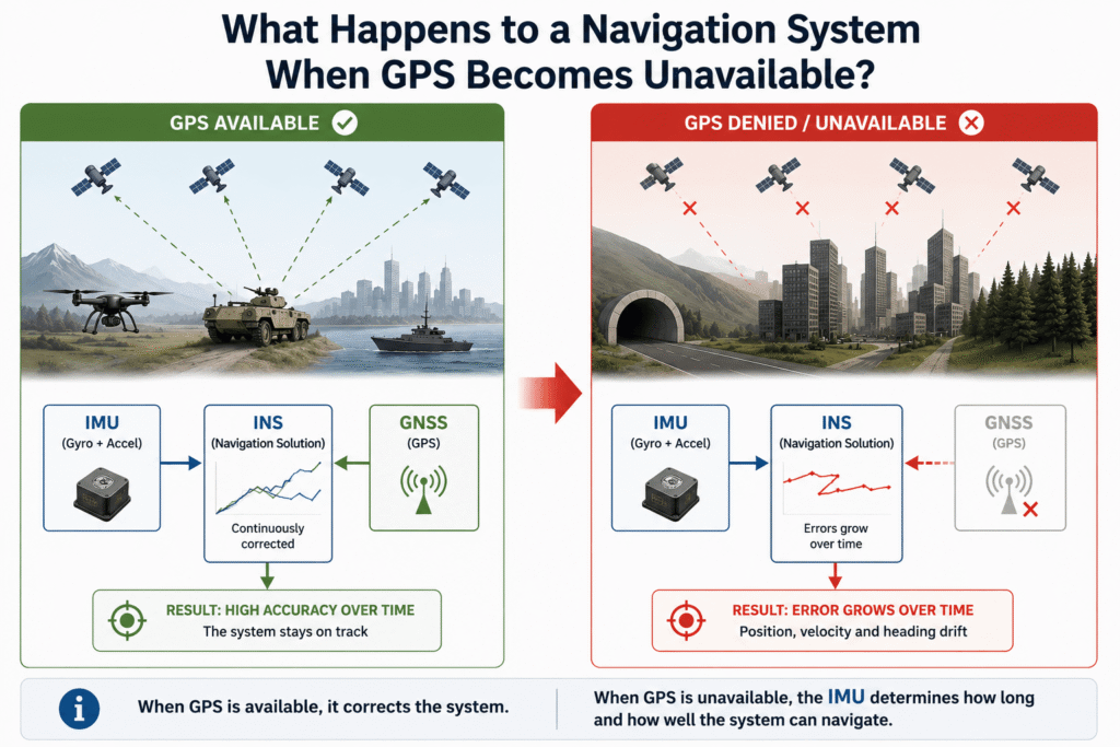
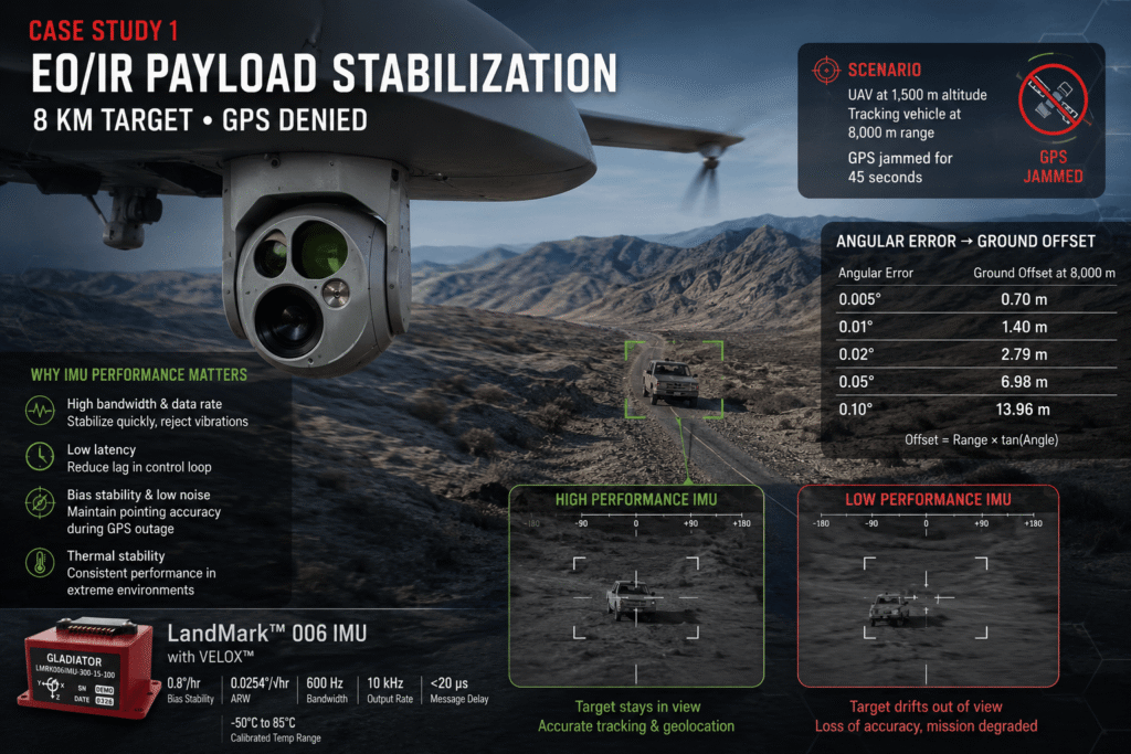
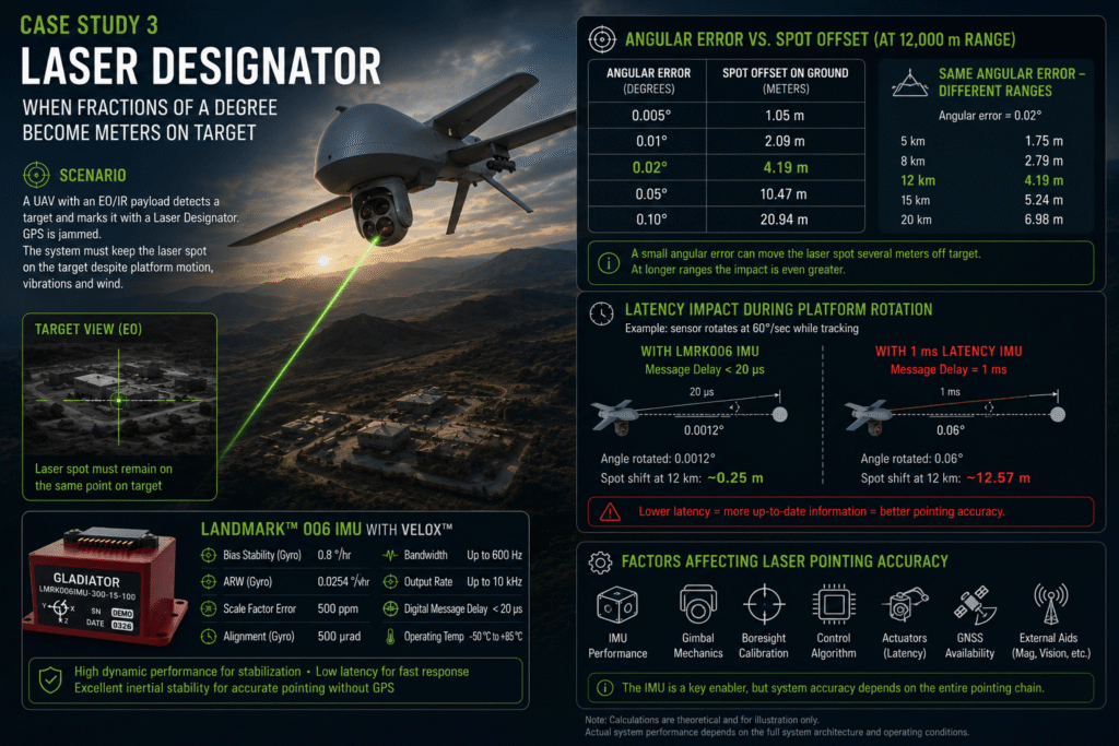
In reality, however, many systems used in defense applications, aerospace, autonomous platforms, and naval systems face a much more important question: not what happens when GPS is available, but what happens the moment it is no longer available.
Today, GPS outages are no longer rare events. Jamming, spoofing, operation inside buildings or tunnels, dense urban environments, forests, canyons, and contested battlefield conditions can all force a navigation system to continue operating without any external position updates.
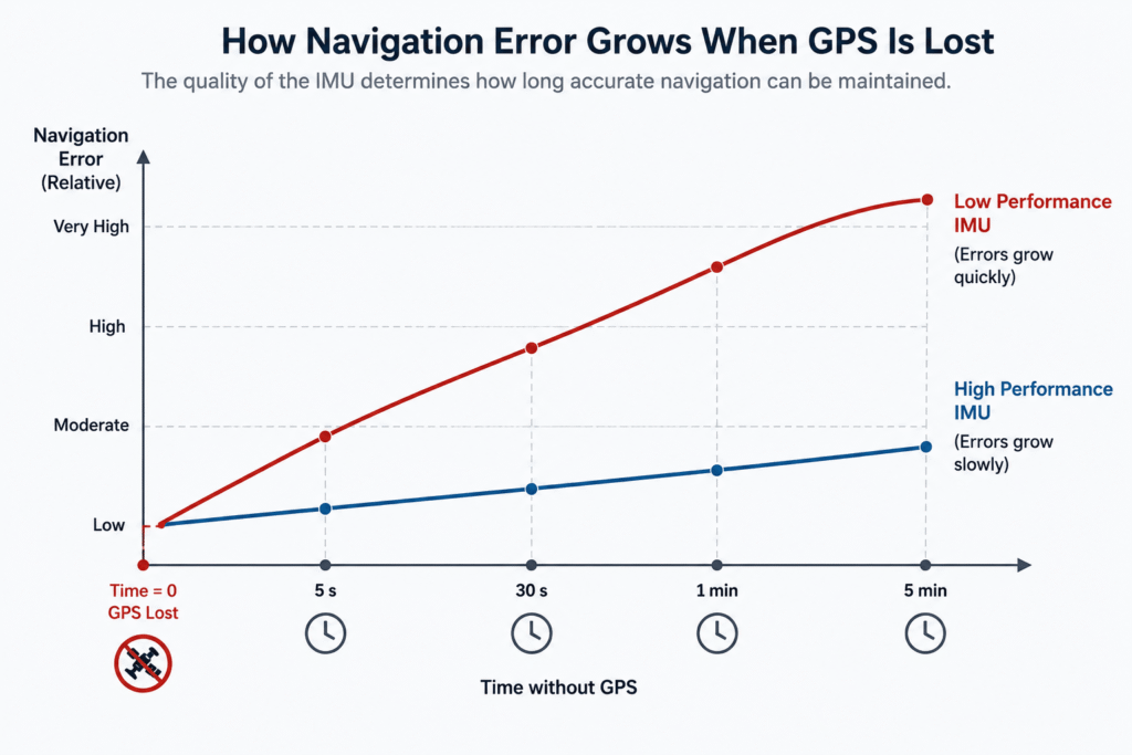
That is the moment when the difference becomes apparent between a system that continues to provide reliable navigation data and one whose position, velocity, and attitude errors begin to grow rapidly.
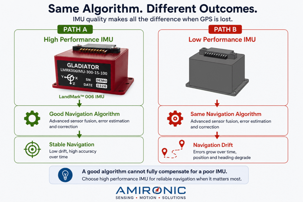
And that difference often comes down to a single engineering decision made months, or even years, earlier:
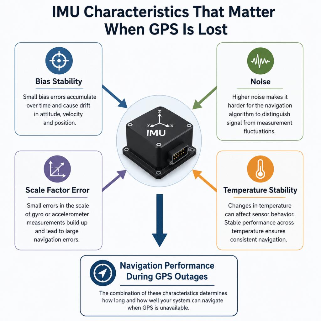
Which IMU was selected for the system.